


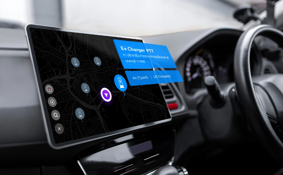


Full offline road navigation map data that strive for excellent navigation experience and ensure precisely arrival of the destination.
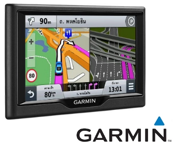
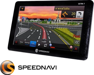
Map for Navigation, Nostra GPS Navigation Map has been widely trusted and accepted in the industry of GPS car navigation devices for more than 10 years. It is the most accurate and detailed GPS navigation system in Thailand. Users can expect every journey to be smooth and safe. It is compatible with a variety of devices including car navigation devices, screen displays, and map navigation applications etc. Our GPS system is trusted by leading GPS navigator companies such as GARMIN, SPEEDNAVIl and leading car dealers such as MG, TOYOTA, ISUZU, MITSHUBISHI, NISSAN etc.
Maps for Navigation are divided into 7 types as follows:
Address point.
The details of house no. location
Landmark
The details of interesting places, in form of point
POI Naming
The other name of landmark for searching supported
Village Point
The details of village location, in form of point
Admin Line
The line of Thailand administrative boundary
Admin Point
The location of Thailand administrative boundary
Admin Poly
The details of Thailand administrative boundary
Country
The details of country and sea boundary
Municipal
The details of Thailand municipal boundary
Public Area
The details of public area, in form of polygon
Sign Post
The details of sign post, in form of point
Turntable
The details of the turn restriction sign which has two dimensional routes
HW Marker
The details of highway location marker, in form of point
Direction Sign
The details of direction sign, in form of point
Lane Info
The details of lane information, in form of point
Bifurcation
The details of bifurcation (Y shape junction), in form of point
TollExit
The details of the Toll Exit which has point of Expressway Exit.
Junctionview
The details of the junction view which has virtual images to navigate correctly to destinations
Landmark Break
Name of POI with break word rules for searching system.
Landmark Disp
Name of POI with abbreviation for Display on device
Landmark Phoneme
Name of POI with symbol instead sounds for Navigation system.
Road Break
Name of Road with break word rules for searching system.
Road Disp
Name of Road with abbreviation for Display on device.
Road Phoneme
Name of Road with symbol instead sounds for Navigation system.
National Park
The details of national park data
Hydrology
The details of the hydrology data
Airport Runway
The details of airport runway data
Building
The details of building data, in form of polygon
Model 3D
The details of 3D Model Building.
Intersection
The position of intersection, also name or signal code
Junction
The position at the end of road that has many types of position such as junction point with traffic signal, traffic signal with red light camera installation, border crossing, railway crossing, toll booth
L trans
The details of road transportation data which has two dimensional route
Route Table
The details of bus line information table and linked to the bus route and the bus stop
Masstransit
The details of the mass transits data which has two dimensional route
Railway
The details of the railway data which has two dimensional route
Bus Stop
The details of bus stop data, in form of point
Bus Route
The details of public transportation data, in form of line
Airport Info
The details of airport position data, in form of point
GT TMC
The details of traffic message channel
Navigation Point
The details of the navigation point which has position of entrance place.
Have a question, or don’t know where to begin? Send us your inquiry today! Our team is readily available to provide help and support wherever possible.
GlobeTech Co., Ltd. (“the Company”, “We”, “Us”) is the developer of the NOSTRA Map Website www.nostramap.com (“Website”, “Services”).
Company respects the privacy of personal data of our users (“You”, “Your”). Company will ensure that our Personal Data Protection Policy is in accordance with the Personal Data Protection Act B.E. 2562 (2019) and other applicable laws. This policy gives a clarification on personal data to be collected, the purpose of our use of such personal data, your options in relation to your personal data.
By accessing our System or Services, you consent to the collection of data and the practice guidelines set forth in this Policy.
Definition of Personal Data
“Personal Data” means any information, where true or false, that relates to an individual and can be used to directly identify such individual, or when used with other information, can directly identify an individual, such as first name, last name, date of birth, address, and telephone number.
The categories of Personal Data to be collected, used, and the data collection methods are described in the table below.
Personal Data of User:
2.1 Personal data of our website visitors who are interested in NOSTRA products is as described in the table below.
Type of Personal Data | Description of Personal Data Type | Retention Period |
Personal data of our website visitors who are interested in NOSTRA products | Your personal data in the NOSTRA Map Website user account data comprise the following data: • Company name | All NOSTRA Map Website user account data that you have provided to us will be maintained (1) throughout the period you remain a user of NOSTRA Map Website (2) for 90 days after the day your account is deleted from the System. |
2.2 Historical website usage data from www.nostramap.com is as described in the table below.
Type of Personal Data | Description of Personal Data Type | Retention Period |
Historical website usage data from www.nostramap.com | Your personal data in the NOSTRA Map Website user account data comprise the following data: • Device’s serial number • User ID • User’s location while using the website | For monitoring and prevention of inappropriate use of the Services or repeat offenses in the System of NOSTRA Map Website, it is necessary that the history and activities regarding your access to the System be retained for 10 years after the day we delete your user account or your data from the System. |
Upon your prior consent or a legal ground for use of your personal data, we will use your personal data in accordance with the details in the table below.
Purpose of Processing | Type of User’s Personal Data to be Processed |
To contact the users for more information about NOSTRA products and services | Personal data in NOSTRA Map Website user account data comprise the following data: • Company name |
To send press releases on new products, services and solutions, including company movements updates for customers to be informed | Personal data in NOSTRA Map Website user account data comprise the following data: • Company name |
To analyze, develop and improve quality of NISTRA products and services | Personal data in NOSTRA Map Website user account data comprise the following data: • IP Address of the device used • Device’s serial number • User ID • User’s location while using the website |
Your Personal Data will be maintained for the period reasonably necessary or specified herein to fulfill the purpose set out in this Personal Data Protection Policy.
We will not disclose any of your Personal Data collected through using of Services on www.nostramap.com to any other person without your prior consent. Disclosure of such data shall be made for the purposes of business administration and provision of the Services on NOSTRA Map Website. You acknowledge and agree that we may disclose your Personal Data to render the Services for such purposes.
Type of Personal Data | Description of Disclosure |
Personal data from NOSTRA’s customers interested form | Form of customers interested in products or services will be stored on Website and will be sent to Sales and Marketing team. We will contact you for giving details or receiving feedback of our products or services. |
Personal data protection and law enforcement agencies | We will share your personal data if we, in our honest belief, deem it necessary for us to do so to comply with the applicable laws, or in response to the legal process such as search warrants, court orders or summons. In addition, we will share your personal data in the event if we honestly believe it necessary for our purposes or for a lawful interest of a third party in relation to national security, law enforcement, legal action, criminal investigation, security of any person, or for prevention of impending death or physical injuries if we deem that such lawful interest overrides your lawful interest or fundamental right and freedom to the protection of your personal data. |
Buyer of our business | We will share your personal data in the event of selling, or negotiation on selling, our business to a buyer or a potential buyer. In such case, NOSTRA Map Website will continue to keep your personal data secret and confidential and give a prior notice to you on the transfer of your personal data to the buyer or your personal data being subject to a different personal data protection policy. |
If the owner of Personal Data is a minor under the age of 10, a request for consent shall be made as follows:
We only collect your personal data which is necessary for the use in relation to the purposes set out in this Policy. We will not collect your sensitive Personal Data, such as race, religious beliefs, political opinions, sexual orientation, disability information, unless:
In our awareness of the security of your Personal Data, we would like to inform you of your rights as the Personal Data Owner as described in the table below.
Type of Right | Description |
Right to Withdraw Consent | You have the right to withdraw the consent for collection, use or disclosure of your personal data. However, such withdrawal will not affect any prior collection, use or disclosure of the personal data made with your consent. As a result of the exercise of this right, you may no longer have access to the Services. |
Right of Access | You have the right to request access to your personal data collected and maintained by us and a copy of such personal data from us, or to request us to disclose the acquisition of such data. |
Right to Rectification | You have the right to request us to rectify or update or complete your personal data collected by us. |
Right to Erasure | You have the right to request that we delete or destroy or make your personal data unidentifiable. We will delete, destroy or make such data unidentifiable from the date of your request. |
Right to Restriction of Processing | We may process your personal data as necessary for improvement of our Services. For the purpose of protection of your privacy, you have the right to request us to stop processing any or all of your personal data. |
Right to Data Portability | You have the right to obtain your personal data by requesting a soft copy of your personal data or the transfer of your personal data for use with the services of other service providers. |
Right to Object | You have the right to object to the storage, use, disclosure of your personal data at any time, as well as the right to object to the processing of your personal data for the purpose of direct marketing. As a result of this objection, you may be deprived of use of any or all Services in the System of NOSTRA Map Website and access to any Services, contents, or the above-mentioned Services as we deem appropriate. |
Remark: you may contact us for the aforementioned actions per details in Clause 14 “Our Contact Details.”
You have the right to request that we delete or destroy or make your personal data collected, used, or disclosed by us unidentifiable of the data owner. Except as required by the law or for establishment, exercise, or defence of a legal claim, we will comply with such request within 90 days from the date of your request. For monitoring and prevention of inappropriate use of the Services or repeat offenses in the System of NOSTRA Map Website, it is necessary that the history and activities regarding your access to the System be retained for 10 years after the day we delete your user account or your data from the System.
We recognize the importance of the security of personal data. We will always strive to ensure that your personal data collected by us will be stored in a proper manner and in accordance with the personal data security practices to prevent loss, ineligible or unlawful and unauthorized access, use, revision, or disclosure of personal data.
We may share your personal data with a third-party service provider outsourced by us for the purposes set out in this Policy only upon your prior consent and in any case, to the extent permitted by the law. We are not liable for any use of your personal data by such third party. You are strongly advised to read the personal data protection policy of the third party to understand how your personal data will be used by that party.
The table below contains a list of the third-party service providers outsourced used by the Company and the reference links of their respective personal data protection policy.
Third-Party Service Provider | Personal Data Protection Policy |
WordPress.org websites |
|
P&T Hosting | www.pathosting.co.th/support/privacy |
www.facebook.com/policy.php | |
www.twitter.com/privacy |
Company and the third-party providers for data analytics and other network marketing advertisers shall use cookies or local storage to store information of how you use the Website www.nostramap.com. This information is stored in your web browser or saved on your computers or mobile devices. Using cookies and storing such information will improve the use of the Services and will make the advertisements display on the Website. This will not harm your computer or the security of your data. If you change to accept, you can choose to disable or control the use of Cookie at the setting of the web browser. This may no longer have access to all or part of the Services on the Website. Read more details in Cookie Policy.
The table below contains a list of the third-party service providers for data analytics used by the Company and the reference links of their respective personal data protection policy.
Third-Party Providers for Data Analytics | Personal Data Protection Policy |
Google Analytics | https://www.google.com/analytics/terms/ |
Google Tag Manager | https://www.google.com/analytics/terms/tag-manager/ |
Facebook Analytics | |
Google Analytics for Firebase | https://firebase.google.com/policies/analytics?hl=th |
The table below contains a list of the third-party service providers for network marketing advertisement used by the Company the reference links of their respective personal data protection policy.
Third-Party Providers for Network Marketing Advertisement | Personal Data Protection Policy |
Google Ad Manager | https://support.google.com/admanager/answer/28390 |
We reserve the right to revise, amend or add any condition in this Policy from time to time, in whole or in part. Upon any update, we will change the effective date. You are strongly advised to review this Personal Data Protection Policy periodically for the updated Personal Data Protection Policy. By using the Services in the System after the announcement of change, you acknowledge and agree to such change.
If you have any enquiries, concerns, complaints, or recommendations regarding our Personal Data Protection Policy, please contact us or write to us the following information:
GlobeTech Co., Ltd.
Address: 202, 14th floor CDG House, Nanglinchi Road, Chong Nonsi, Yannawa, Bangkok 10120
Telephone: 02-678-0995
E-mail : marketing.nostra@cdg.co.th
Website: https://www.nostramap.com
Name: ANOTAI SORNWATTANA
Address: 202, 19th floor CDG House, Nanglinchi Road, Chong Nonsi, Yannawa, Bangkok 10120
Telephone: 02-678-0200
E-mail : DPO@cdg.co.th
นโยบายคุ้มครองข้อมูลส่วนบุคคล เว็บไซต์ NOSTRA Map
บริษัท โกลบเทค จำกัด (“บริษัท” “เรา” หรือ “โกลบเทค”) เป็นผู้นำการให้บริการโซลูชันด้านข้อมูลแผนที่ดิจิทัลและ Location Contents ครอบคลุมภูมิภาคเอเชียตะวันออกเฉียงใต้ ภายใต้แบรนด์ “นอสตร้า” (NOSTRA) ข้อมูลแผนที่เพื่อการใช้งานร่วมกับระบบสารสนเทศทางภูมิศาสตร์ (Geographic Information System: GIS) บริการแผนที่ออนไลน์ NOSTRA Online Map Services และบริการข้อมูลแผนที่นำทางอันดับ 1 ในตลาดระบบจีพีเอสในรถยนต์มากกว่า 10 ปี ปัจจุบันร่วมมือกับพาร์ทเนอร์ ขยายการให้บริการทางด้าน Data Analytics, IoT และ Smart Solutions โดยจัดทำเว็บไซต์ www.nostramap.com ขององค์กร เพื่อใช้ในการสื่อสาร ให้ความรู้ความเข้าใจ ความเคลื่อนไหว เกี่ยวกับบริษัท สินค้า และบริการที่เราพร้อมให้บริการกับลูกค้าและผู้ที่สนใจทั่วไป ผ่านทางเว็บไซต์ และ/หรือ แอปพลิเคชันต่าง ๆ รวมถึงผลิตภัณฑ์ต่าง ๆ ที่อาจมีขึ้นในอนาคตของ NOSTRA (“เว็บไซต์”)
บริษัทตระหนักถึงความสำคัญของข้อมูลส่วนบุคคลของผู้เข้าเยี่ยมชมเว็บไซต์และลูกค้า (“ท่าน”) และเคารพสิทธิความเป็นส่วนตัวของท่าน บริษัทขอเรียนให้ท่านทราบว่า บริษัทมีนโยบายในการคุ้มครองข้อมูลส่วนบุคคลของท่านตามที่กำหนดไว้ภายใต้พระราชบัญญัติคุ้มครองข้อมูลส่วนบุคคล พ.ศ. 2562 และกฎหมายอื่นที่เกี่ยวข้อง นโยบายฉบับนี้จัดทำขึ้นเพื่อชี้แจงรายละเอียดเกี่ยวกับข้อมูลส่วนบุคคลที่จะทำการรวบรวม วัตถุประสงค์ที่บริษัทใช้ข้อมูลส่วนบุคคลนั้น ๆ ทางเลือกของท่านเกี่ยวกับข้อมูลส่วบุคคลที่เกี่ยวกับท่าน ทั้งนี้ การที่ท่านเข้าสู่ระบบหรือบริการของเรา ถือว่าท่านให้ความยินยอมในการเก็บรวบรวมข้อมูลและใช้แนวทางปฎิบัติตามที่อธิบายในนโยบายฯ ฉบับนี้
นิยามของข้อมูลส่วนบุคคล
“ข้อมูลส่วนบุคคล” หมายถึง ข้อมูลเกี่ยวกับบุคคลซึ่งทำให้สามารถระบุตัวบุคคลนั้นได้ไม่ว่าทางตรงหรือทางอ้อม ไม่ว่าจริง หรือเท็จ หรือเมื่อรวมกับข้อมูลอื่น ๆ แล้วจะสามารถระบุตัวบุคคลได้โดยตรง เช่น ชื่อ นามสกุล วันเกิด ที่อยู่ หมายเลขโทรศัพท์ เป็นต้น
บริษัทมีการเก็บรวบรวม ใช้ และวิธีการเก็บข้อมูลดังประเภทที่ปรากฎไว้ในตารางด้านล่างนี้
ข้อมูลส่วนบุคคลของผู้ใช้บริการ:
2.1 ข้อมูลส่วนบุคคลของผู้ใช้บริการเว็บไซต์ที่มีความสนใจผลิตภัณฑ์นอสตร้า อธิบายรายละเอียดตามตารางด้านล่าง
| ประเภทของข้อมูลส่วนบุคคล | คำอธิบายประเภทของข้อมูลส่วนบุคคล | ระยะเวลาในการเก็บข้อมูล |
| ข้อมูลส่วนบุคคลของผู้ใช้บริการเว็บไซต์ที่มีความสนใจผลิตภัณฑ์นอสตร้า | ข้อมูลส่วนบุคคลของท่านที่อยู่ในบัญชีผู้เข้าใช้งาน จะประกอบด้วยข้อมูลดังนี้ • ชื่อ – นามสกุล • อีเมล • เบอร์โทรศัพท์ • ชื่อบริษัท | บริษัทจะจัดเก็บข้อมูลส่วนบุคคลทั้งหมดที่ท่านได้ให้แก่บริษัท นับจากวันที่ทำการลงทะเบียนบนเว็บไซต์ NOSTRA Map (1) ตลอดระยะเวลาที่ท่านยังคงเป็นผู้ใช้บริการเว็บไซต์ และ (2) ภายใน 90 วันหลังจากวันที่ท่านร้องขอลบบัญชีออกจากระบบ |
2.2 ข้อมูลประวัติการเข้าใช้งานเว็บไซต์ www.nostramap.com ที่มีต่อบริการต่าง ๆ อธิบายรายละเอียดตามตารางด้านล่าง
| ประเภทของข้อมูลส่วนบุคคล | คำอธิบายประเภทของข้อมูลส่วนบุคคล | ระยะเวลาในการเก็บข้อมูล |
| ข้อมูลประวัติการเข้าใช้งานเว็บไซต์ www.nostramap.com ที่มีต่อบริการต่าง ๆ เพื่อการวิเคราะห์และปรับปรุงคุณภาพการให้บริการ | ข้อมูลส่วนบุคคลของท่านที่อยู่ในบัญชีผู้เข้าใช้งาน จะประกอบด้วยข้อมูลดังนี้ • IP Address ของอุปกรณ์ • รหัสเฉพาะของอุปกรณ์ • รหัสเฉพาะของผู้ใช้งาน • ค่าพิกัดของท่านขณะใช้งานเว็บไซต์ | เพื่อตรวจสอบและป้องกันไม่ให้เกิดการใช้บริการที่ไม่เหมาะสมหรือการกระทำความผิดซ้ำในเว็บไซต์ NOSTRA Map บริษัทมีความจำเป็นต้องเก็บรักษาข้อมูลส่วนบุคคลบางประการของท่านในระบบต่อไปเป็นระยะเวลา 10 ปี หลังจากวันที่บริษัทลบบัญชีผู้ใช้งานหรือข้อมูลของท่านออกจากระบบ |
เมื่อบริษัทได้รับความยินยอมจากท่าน หรือเมื่อมีฐานทางกฎหมายสำหรับการใช้ข้อมูลส่วนบุคคลของท่าน บริษัทจะเก็บรวบรวม ใช้ และประมวลผลข้อมูลส่วนบุคคลของท่านเพื่อวัตถุประสงค์ตามรายละเอียดในตารางด้านล่างนี้
| วัตถุประสงค์ในการประมวลผล | ประเภทข้อมูลส่วนบุคคลของผู้ใช้บริการที่ใช้การประมวลผล |
| เพื่อติดต่อสอบถามและแนะนำข้อมูลเพิ่มเติมเกี่ยวกับผลิตภัณฑ์และบริการของนอสตร้า | ข้อมูลส่วนบุคคลเพื่อติดต่อสอบถามและแนะนำข้อมูลเพิ่มเติมเกี่ยวกับผลิตภัณฑ์และบริการของนอสตร้า ประกอบด้วย • ชื่อ – นามสกุล • อีเมล • เบอร์โทรศัพท์ • ชื่อบริษัท |
| เพื่อส่งข่าวสารประชาสัมพันธ์สินค้า บริการ และโซลูชั่นใหม่ ๆ รวมถึงความเคลื่อนไหวของบริษัทฯ อัปเดทให้กับลูกค้าได้รับทราบ | ข้อมูลส่วนบุคคลเพื่อส่งข่าวสารประชาสัมพันธ์สินค้า บริการ และโซลูชั่นใหม่ ๆ รวมถึงความเคลื่อนไหวของบริษัทฯ อัปเดทให้กับลูกค้าได้รับทราบ ประกอบด้วย • ชื่อ – นามสกุล • อีเมล • เบอร์โทรศัพท์ • ชื่อบริษัท |
| เพื่อวิเคราะห์ ออกแบบ พัฒนาและปรับปรุงเว็บไซต์ และ/หรือ สินค้าและบริการของ NOSTRA Map ให้สามารถสร้างประสบการณ์ที่ดีขึ้น | ข้อมูลส่วนบุคคลเพื่อวิเคราะห์ ออกแบบ พัฒนาและปรับปรุงเว็บไซต์ และ/หรือ สินค้าและบริการของ NOSTRA Map ให้สามารถสร้างประสบการณ์ที่ดีขึ้น ประกอบด้วย • IP Address ของอุปกรณ์ • รหัสเฉพาะของอุปกรณ์ • รหัสเฉพาะของผู้ใช้งาน • ค่าพิกัดของท่านขณะใช้งานเว็บไซต์ |
บริษัทจะเก็บข้อมูลส่วนบุคคลของท่านในระยะเวลาเท่าที่จำเป็นอย่างสมเหตุสมผล หรือตามระยะเวลาที่กำหนดไว้ในนโยบายฯ ฉบับนี้ เพื่อให้บรรลุตามวัตถุประสงค์ที่ระบุในนโยบายคุ้มครองข้อมูลส่วนบุคคลนี้
บริษัทจะไม่เปิดเผยข้อมูลส่วนบุคคลใด ๆ ของท่านที่ได้มีการเก็บรวบรวมผ่านการใช้บริการบนเว็บไซต์ www.nostramap.com ต่อบุคคลอื่นโดยปราศจากความยินยอมจากท่าน ซึ่งการเปิดเผยดังกล่าวจะกระทำภายใต้วัตถุประสงค์ของการบริหารงานและการให้บริการบนเว็บไซต์ โดยท่านตกลงและยินยอมให้บริษัทเปิดเผยข้อมูลส่วนบุคคลของท่านเพื่อการให้บริการอันเป็นไปตามวัตถุประสงค์ได้
| ประเภทของข้อมูลส่วนบุคคล | คำอธิบายวิธีการเผยแพร่ของประเภทข้อมูล |
| ข้อมูลในแบบฟอร์มลูกค้าที่สนใจบริการ หรือสินค้าของบริษัท | แบบฟอร์มและความสนใจของลูกค้าที่สนใจบริการ หรือสินค้าของบริษัทที่บันทึกไว้บนเว็บไซต์ www.nostramap.com จะถูกส่งต่อไปยังทีมฝ่ายขาย ฝ่ายบริการลูกค้า และฝ่ายการตลาด ใช้เพื่อการติดต่อให้รายละเอียด นำเสนอสินค้าบริการ สอบถามความพึงพอใจในการได้รับบริการจาก www.nostramap.com เท่านั้น |
| หน่วยงานบังคับใช้กฎหมายและคุ้มครองข้อมูลส่วนบุคคล | บริษัทจะแชร์ข้อมูลส่วนบุคคลของท่านเมื่อบริษัทเชื่อโดยสุจริตว่ามีความจำเป็นที่บริษัทจะต้องทำเช่นนั้น เพื่อที่จะปฏิบัติตามข้อผูกพันทางกฎหมายตามกฎหมายที่บังคับใช้ หรือเพื่อที่จะตอบสนองต่อกระบวนการทางกฎหมายโดยชอบ เช่น หมายค้น คำสั่งศาล หรือหมายเรียก นอกจากนี้ บริษัทจะแชร์ข้อมูลส่วนบุคคลของท่านในกรณีที่บริษัทเชื่อโดยสุจริตว่ามีความจำเป็นสำหรับวัตถุประสงค์ของบริษัทเอง หรือสำหรับประโยชน์โดยชอบด้วยกฎหมายของบุคคลที่สามอันเกี่ยวกับความมั่นคงของประเทศ การบังคับใช้กฎหมาย การฟ้องร้องคดี การสอบสวนทางอาญา การคุ้มครองความปลอดภัยของบุคคลใด ๆ หรือเพื่อป้องกันการเสียชีวิตหรือการเป็นอันตรายแก่ร่างกายอันใกล้จะถึง หากบริษัทเห็นว่าประโยชน์โดยชอบด้วยกฎหมายดังกล่าวอยู่เหนือกว่าประโยชน์ด้วยกฎหมายหรือสิทธิและเสรีภาพที่ขั้นพื้นฐานของท่านที่กำหนดให้ต้องมีการการคุ้มครองข้อมูลส่วนบุคคลของท่าน |
| ผู้ซื้อธุรกิจของบริษัท | บริษัทจะแชร์ข้อมูลส่วนบุคคลของท่านในกรณีต่าง ๆ ที่บริษัทขายหรือเจรจาต่อรองเพื่อขายธุรกิจของบริษัทให้แก่ผู้ซื้อหรือผู้ที่อาจจะซื้อธุรกิจของบริษัท ในกรณีดังกล่าวนี้ ผู้ซื้อธุรกิจของบริษัทจะยังคงรักษาความลับของข้อมูลส่วนบุคคลของท่านต่อไป และให้คำบอกกล่าวแก่ท่านเพื่อให้ท่านทราบก่อนมีการโอนข้อมูลส่วนบุคคลของท่านไปยังผู้ซื้อหรือก่อนที่ข้อมูลส่วนบุคคลของท่านต้องอยู่ภายใต้บังคับนโยบายความเป็นส่วนตัวที่แตกต่างไป |
ในกรณีที่เจ้าของข้อมูลส่วนบุคคลเป็นผู้เยาว์ซึ่งเป็นบุคคลที่มีอายุต่ำกว่า 20 ปีบริบูรณ์ การขอความยินยอมจากเจ้าของข้อมูลส่วนบุคคลดังกล่าวให้ดำเนินการดังนี้
บริษัทจะเก็บรวบรวมข้อมูลส่วนบุคคลของท่านเฉพาะข้อมูลที่จำเป็นเพื่อประโยชน์ในการใช้ข้อมูลส่วนบุคคลตามวัตถุประสงค์ที่ระบุในนโยบายฯ ฉบับนี้เท่านั้น และบริษัทจะไม่จัดเก็บข้อมูลส่วนบุคคลที่ละเอียดอ่อนของท่าน เช่น เชื้อชาติ ศาสนา ความคิดเห็นทางการเมือง พฤติกรรมทางเพศ ลักษณะความพิการ เป็นต้น เว้นแต่
บริษัทตระหนักถึงการรักษาข้อมูลส่วนบุคคลของท่าน บริษัทจึงขอแจ้งสิทธิของท่านในฐานะเจ้าของข้อมูลส่วนบุคคล ดังข้อมูลตามตารางด้านล่างต่อไปนี้
| ประเภทของสิทธิ | คำอธิบายประเภทของสิทธิ |
| สิทธิในการถอดถอนความยินยอม (Right to Withdraw Consent) | ท่านมีสิทธิถอดถอนความยินยอมการเก็บรวบรวม การใช้ หรือการเปิดเผยข้อมูลส่วนบุคคลของท่านได้ แต่การถอดถอนความยินยอมของท่านจะไม่กระทบต่อการเก็บ รวบรวม ใช้ หรือเปิดเผยข้อมูลส่วนบุคคลที่ท่านให้ความยินยอมไปแล้วก่อนหน้านี้ ทั้งนี้ การใช้สิทธิดังกล่าวอาจมีผลทำให้ท่านไม่สามารถเข้าใช้บริการได้อีกต่อไป |
| สิทธิในการเข้าถึงข้อมูลส่วนบุคคล (Right to Access) | ท่านมีสิทธิขอเข้าถึงข้อมูลส่วนบุคคลของท่านที่บริษัทจัดเก็บไว้ ตลอดจนขอรับสำเนาข้อมูลส่วนบุคคล หรือขอให้เปิดเผยถึงการได้มาซึ่งข้อมูลส่วนบุคคลดังกล่าวได้จากบริษัท |
| สิทธิในการแก้ไขให้เป็นปัจจุบัน (Right to Rectification) | ท่านมีสิทธิร้องขอให้บริษัทดำเนินการแก้ไขหรือปรับปรุงให้ข้อมูลส่วนบุคคลของท่านที่บริษัทจัดเก็บไว้เป็นข้อมูลที่ถูกต้อง เป็นปัจจุบัน และสมบูรณ์ได้ |
| สิทธิในการลบข้อมูลส่วนบุคคล (Right to Erasure) | ท่านมีสิทธิที่จะร้องขอให้บริษัทลบ หรือทำลาย หรือทำให้ข้อมูลส่วนบุคคลของท่านเป็นข้อมูลที่ไม่สามารถระบุตัวตนได้ โดยบริษัทจะดำเนินการลบ หรือทำลาย หรือทำให้ข้อมูลดังกล่าวเป็นข้อมูลที่ไม่สามารถระบุตัวตนนับแต่วันที่ได้รับคำร้องขอ |
| สิทธิในการยับยั้งการใช้ข้อมูลส่วนบุคคล (Right to Restriction of Processing) | บริษัทจะประมวลผลข้อมูลส่วนบุคคลของท่านเท่าที่จำเป็นเพื่อพัฒนาการให้บริการของบริษัท เพื่อประโยชน์ในการรักษาความเป็นส่วนตัวของท่าน ท่านมีสิทธิที่จะร้องขอให้บริษัทหยุดการประมวลผลข้อมูลส่วนบุคคลของท่านทั้งหมดหรือบางส่วน |
| สิทธิในการให้โอนย้ายข้อมูลส่วนบุคคล (Right to Data Portability) | ท่านมีสิทธิขอรับข้อมูลส่วนบุคคล โดยท่านสามารถร้องขอสำเนาข้อมูลส่วนบุคคลของท่านในรูปแบบอิเล็กทรอนิกส์ หรือโอนข้อมูลส่วนบุคคลของท่านเพื่อนำไปใช้กับบริการของผู้ให้บริการรายอื่น |
| สิทธิในการคัดค้านการประมวลผลข้อมูลส่วนบุคคล (Right to Object) | ท่านมีสิทธิในการคัดค้านการเก็บ ใช้ หรือเปิดเผยข้อมูลส่วนบุคคลของท่านเมื่อใดก็ได้ รวมถึงสิทธิในการคัดค้านไม่ให้ข้อมูลส่วนบุคคลของท่านถูกประมวลผลเพื่อวัตถุประสงค์ทางการตลาดทางตรง ซึ่งการคัดค้านนี้อาจส่งผลให้ท่านไม่สามารถใช้บริการทั้งหมดหรือบางส่วนในเว็บไซต์ NOSTRA Map รวมทั้งสิทธิในการเข้าใช้บริการต่าง ๆ เนื้อหา หรือบริการข้างต้นตามที่บริษัทเห็นสมควรได้ |
ท่านสามารถติดต่อเราเพื่อดำเนินการดังกล่าวข้างต้นได้ตามรายละเอียดข้อ 14 รายละเอียดการติดต่อเรา
ท่านอาจมีสิทธิขอให้เราดำเนินการลบ หรือทำลาย หรือทำให้ข้อมูลส่วนบุคคลของท่านที่เราเก็บรวบรวม ใช้ หรือเปิดเผย เป็นข้อมูลที่ไม่สามารถระบุตัวบุคคลที่เป็นเจ้าของข้อมูลได้ บริษัทจะดำเนินการดังกล่าวภายใน 90 วันนับจากวันที่ท่านได้ร้องขอ เว้นแต่การเก็บรักษาข้อมูลดังกล่าวของเรานั้นเป็นไปเพื่อปฎิบัติตามกฎหมาย หรือเพื่อก่อตั้งสิทธิเรียกร้องตามกฎหมาย เพื่อการใช้หรือการยกขึ้นต่อสู้ซึ่งสิทธิเรียกร้องตามกฎหมาย ทั้งนี้เพื่อตรวจสอบและป้องกันไม่ให้เกิดการใช้บริการที่ไม่เหมาะสมหรือการกระทำความผิดซ้ำในเว็บไซต์ บริษัทมีความจำเป็นต้องเก็บรักษาข้อมูลส่วนบุคคลบางประการของท่านในระบบต่อไปเป็นระยะเวลา 10 ปี หลังจากวันที่บริษัทลบบัญชีผู้ใช้งานหรือข้อมูลของท่านออกจากระบบ
บริษัทตระหนักถึงความสำคัญของการรักษาความปลอดภัยของข้อมูลส่วนบุคคล บริษัทจะดำเนินการให้ท่านมั่นใจว่าข้อมูลส่วนบุคคลของท่านที่เก็บรวบรวมโดยบริษัทจะได้รับการจัดเก็บอย่างเหมาะสมและสอดคล้องกับการรักษาความลับของข้อมูลส่วนบุคคล เพื่อป้องกันการสูญหาย การเข้าถึง การใช้งาน การแก้ไข การเปิดเผยข้อมูลส่วนบุคคลโดยไม่มีสิทธิหรือไม่ชอบด้วยกฎหมายและโดยมิได้รับอนุญาต
เราอาจแบ่งปันข้อมูลส่วนบุคคลของท่านให้แก่ผู้ให้บริการภายนอกที่ปฏิบัติงานให้แก่บริษัทเพื่อวัตถุประสงค์ที่ได้กล่าวไว้ในนโยบายฯ ฉบับนี้ภายใต้ความยินยอมของท่านทุกกรณีเท่าที่กฎหมายอนุญาต บริษัทจะไม่มีความรับผิดใด ๆ ทั้งสิ้นอันเกิดจากการใช้ข้อมูลส่วนบุคคลของท่านโดยบุคคลภายนอก ดังนั้น โปรดตรวจสอบนโยบายคุ้มครองข้อมูลส่วนบุคคลของบุคคลภายนอกเพื่อทำความเข้าใจว่าบุคคลเหล่านั้นใช้ข้อมูลส่วนบุคคลของท่านอย่างไร
ตารางด้านล่างแสดงรายชื่อผู้ให้บริการภายนอกทั้งหมดที่บริษัทใช้บริการ และเอกสารอ้างอิงไปยังนโยบายคุ้มครองข้อมูลส่วนบุคคลของผู้ให้บริการภายนอกเหล่านั้น
| ผู้ให้บริการภายนอก | นโยบายความเป็นส่วนตัว |
| WordPress.org websites | https://th.wordpress.org/about/privacy/ |
| P&T Hosting | www.pathosting.co.th/support/privacy |
| www.facebook.com/policy.php | |
| www.twitter.com/privacy |
บริษัทและผู้ให้บริการวิเคราะห์ข้อมูลบุคคลที่สาม และผู้ประกอบการโฆษณาเพื่อการตลาดในเครือข่ายอื่น ๆ อาจใช้คุกกี้ (Cookie) หรือการจัดเก็บข้อมูลบนเครื่อง (Local Storage) เพื่อจัดเก็บข้อมูลการเข้าถึงหรือวิธีที่ท่านใช้งานเว็บไซต์ www.nostramap.com ไว้ที่เว็บเบราว์เซอร์หรือบันทึกไว้บนเครื่องคอมพิวเตอร์หรืออุปกรณ์สื่อสารของท่าน การใช้คุกกี้และการจัดเก็บข้อมูลบนเครื่องดังกล่าวจะช่วยปรับปรุงการใช้บริการของท่านให้ดีขึ้น และทำให้โฆษณาที่แสดงบนเว็บไซต์ www.nostramap.com มีความเกี่ยวข้องกับพฤติกรรมและความสนใจของท่านมากขึ้น ซึ่งการจัดเก็บข้อมูลนี้จะไม่เป็นอันตรายต่อเครื่องคอมพิวเตอร์หรือความปลอดภัยของข้อมูลของท่านท่านสามารถปิดหรือควบคุมการใช้งานคุกกี้ด้วยการตั้งค่าเว็บเบราว์เซอร์หรืออุปกรณ์สื่อสารที่ท่านใช้งาน เพื่อเปลี่ยนแปลงการตั้งค่าที่ยอมรับไว้ ซึ่งอาจส่งผลให้ท่านไม่สามารถใช้บริการทั้งหมดหรือบางส่วนในเว็บไซต์ www.nostramap.com รวมทั้งปิดกั้นการเข้าถึงฟีเจอร์ เนื้อหาหรือบริการข้างต้นตามที่บริษัทเห็นสมควร อ่านเพิ่มเติมได้ที่ นโยบายคุกกี้ ตารางด้านล่างแสดงรายชื่อผู้ให้บริการวิเคราะห์ข้อมูลบุคคลที่สามทั้งหมดที่บริษัทใช้บริการ และเอกสารอ้างอิงไปยังนโยบายความเป็นส่วนตัวของผู้ให้บริการวิเคราะห์ข้อมูลบุคคลที่สามเหล่านั้น
ตารางด้านล่างแสดงรายชื่อผู้ให้บริการภายนอกทั้งหมดที่บริษัทใช้บริการ และเอกสารอ้างอิงไปยังนโยบายคุ้มครองข้อมูลส่วนบุคคลของผู้ให้บริการวิเคราะห์ข้อมูลบุคคลภายนอกเหล่านั้น
| ผู้ให้บริการวิเคราะห์ข้อมูลภายนอก | นโยบายความเป็นส่วนตัว |
| Google Analytics | https://www.google.com/analytics/terms/ https://policies.google.com/privacy |
| Google Tag Manager | https://www.google.com/analytics/terms/tag-manager/ https://policies.google.com/privacy |
| Facebook Analytics | https://www.facebook.com/privacy/explanation |
| Google Analytics for Firebase | https://firebase.google.com/policies/analytics?hl=th https://firebase.google.com/terms/analytics?hl=th |
ตารางด้านล่างแสดงรายชื่อผู้ให้บริการภายนอกซึ่งเป็นผู้โฆษณาเพื่อการตลาดในเครือข่ายที่บริษัทใช้บริการ และเอกสารอ้างอิงไปยังนโยบายคุ้มครองข้อมูลส่วนบุคคลของผู้ให้บริการภายนอกซึ่งเป็นผู้โฆษณาเพื่อการตลาดในเครือข่ายเหล่านั้น
| ผู้ให้บริการโฆษณาภายนอก | นโยบายความเป็นส่วนตัว |
| Google Ad Manager | https://support.google.com/admanager/answer/2839090?hl=th &ref_topic=28145https://policies.google.com/privacy |
บริษัทขอสงวนสิทธิ์ในการแก้ไข เปลี่ยนแปลง หรือเพิ่มเติมเงื่อนไขนโยบายนี้ไม่ว่าบางส่วนหรือทั้งหมดเป็นครั้งคราว เมื่อเราดำเนินการปรับปรุง เราจะแก้ไขวันที่มีผลบังคับใช้ ท่านควรเข้าตรวจสอบนโยบายคุ้มครองข้อมูลส่วนบุคคลฉบับนี้เป็นระยะ เพื่อที่จะทราบถึงข้อกำหนดข้อมูลส่วนบุคคลฉบับล่าสุด การใช้บริการในระบบของท่านหลังจากที่ได้มีการประกาศเปลี่ยนแปลงดังกล่าวจะถือว่าท่านยอมรับการเปลี่ยนแปลงดังกล่าวแล้ว
ท่านสามารถติดต่อเราหากท่านมีข้อสงสัยหรือคำถามเกี่ยวกับนโยบายคุ้มครองข้อมูลส่วนบุคคลประการใด โปรดติดต่อสอบถามได้ที่
บริษัท โกลบเทค จำกัด
เลขที่ 202 ถนนนางลิ้นจี่ แขวงช่องนนทรี ยานนาวา กรุงเทพมหานคร 10120
โทรศัพท์ : +66 (0) 2-678-0995
E-mail : marketing.nostra@cdg.co.th
เจ้าหน้าที่คุ้มครองข้อมูลส่วนบุคคล (Data Protection Officer: DPO)
ชื่อ-นามสกุล : นายอโณทัย ศรวัฒนะ
ที่อยู่ : เลขที่ 202 ชั้น 19 อาคาร CDG House ถนนนางลิ้นจี่ แขวงช่องนนทรี ยานนาวา กรุงเทพมหานคร 10120
โทรศัพท์ : 02-678-0200
อีเมล : DPO@cdg.co.th